Tuesday 3/30/99
The West Rim
Tuesday was a day for sleeping in a bit. In fact, we did not rise until well after the sun did. We decided that we would designate Tuesday monring "laundry day" and spent most of the morning washing clothes. No pictures were taken of this event. :)
After returning to the lodge with lots of clean clothes, we decided to go out and have a more detailled look at the West Rim, and stop at a few of the places that the tour did not.
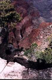
Our first stop on the West Rim was at the Abyss. This is a very steep area between two points, and the road goes right up to the edge in some places. The view down is quite impressive.
The Abyss lookout area also gave us our best view of the bedrock at the Canyon (also called Vishnu Schist, or "Creation Rock"). This is the rock that composes the mantle of the Earth, and is the oldest visible rock in the world (1.5 to 2 Billion years old).
This picture shows a fairly good overview of the Abyss area. The view from the Abyss is impressive because you can see so far away (in fact, the other Canyon wall was barely visible in the haze, and it was a pretty clear day).
Our next stop was Pima Point. Pima Point looks out to another point on the same side of the Canyon (just to the left of the center of this Pano). It actually looks a little like the Canyon continues on to the left (West) in this photo. However, the Canyon actually heads roughly North (straight ahead in the photo - see the Colorado River?), then turns back West later on. The "Canyon" to the West is actually where one of the smaller rivers leads into the Colorado.

<Pima Point Outlook - LiveImage Plugin Required>
<Pima Point Outlook - JPEG Format (No Plugin Required)>
From Pima Point, we walked on to Hermits Rest. This is where the trailhead to the Hermits Rest Trail is located. Looking out from this area, you can see the river that formed the smaller "Canyon" shown in the previous Panoramic photo.
From Pima, we took the bus back to Mohave Point. A couple of Panoramic shots were taken (one of these will be posted here later - Panos take a long time to set up...).
After Mohave Point, we took the bus back to El Tovar, and took the Village Loop bus back to Yavapai for a short break, then walked out to the Rim Trail and back to the Village so we could have another try at the Arizona Steakhouse.
Along the way, there was a vantage point where we could see the smoke from the controlled burn that was being done somewhere north of the North Rim. The Park Service intentionally burns brush out from under the trees from time to time. This helps keep the forest healthier and deprives a forest fire of a lot of fuel should one break out.
As luck would have it, we made it there just before 4:00 and waited at the door until they opened a little after 4:30. Being first in line, we got a table next to the window and had a great dinner.
After dinner, we walked back via the Rim Trail and watched the Sunset.
When we returned to the Lodge, we all decided that we would leave the Canyon a day early. We had been to every Point twice, and seen all that we possibly could. We had intended to walk a portion of the Bright Angel Trail, but decided that we would use the day to do some extra touring in the Flagstaff area instead. We didn't know it at the time, but we were really fortunate to have left when we did...
Later that night, Nate and Brenda ventured out (it being the full moon) for a look at the Canyon in moonlight, where a few pictures were taken.